FIRST… do you know what ANWR is?
ANWR = Arctic National Wildlife Refuge.
...
Now… A comparison

And Some perspective
 A
A(it's in the "ANWR Coastal Plain")
This is what those who are against drilling in ANWR show you when they talk about ANWAR


Isn't ANWR BEAUTIFUL? Why should we drill here (AND DESTROY) this BEAUTIFUL place?
........................................
.........................................Well... That's not exactly the truth
Do you remember the map?
The map showed that the proposed drilling area is in the ANWR Coastal Plain
Do those photographs look like a coastal plain to you?
????????
THE ANSWER IS SIMPLE…
THAT IS NOT WHERE THEY ARE WANTING TO DRILL!
THIS IS WHAT THE PROPOSED EXPLORATION AREA ACTUALLY LOOKS LIKE IN THE WINTER

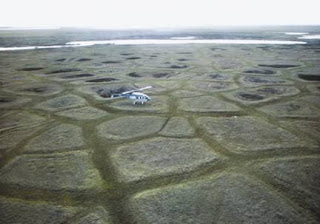
AND THIS IS WHAT IT ACTUALLY LOOKS LIKE IN THE SUMMER

HERE ARE A COUPLE SCREEN SHOTS FROM GOOGLE EARTH
(Thanks Google...)
AS YOU CAN SEE, THE AREA WHERE THEY ARE TALKING ABOUT DRILLING IS A BARREN WASTELAND.
OH… AND THEY SAY THAT THEY ARE CONCERNED ABOUT THE EFFECT ON THE LOCAL WILDLIFE…
HERE IS A PHOTO (SHOT DURING THE SUMMER) OF THE"DEPLETED WILDLIFE" SITUATION CREATED BY DRILLING AROUND PRUDHOE BAY *…DON'T YOU THINK THAT THE CARIBOU REALLY HATE THAT DRILLING?
*the Prudhoe bay area accounts for 17% of U.S. domestic oil production
We Need to Drill!


No comments:
Post a Comment